 _
_
 _
_
The Owls of the Western Hemisphere Atlas
The Owls of the Western Hemisphere Atlas creted in 2004 provides the ranges for all the owl species in the western hemisphere in an interactive map-based application. Some topics link the owl range to a picture of the owl and/or a source for further information.
You can easily add your own pictures and information to the atlas.
The atlas also contains a topic that links the breeding birds list to each US State and Canadian Province.
Downloading
the Atlas:
Download Dynamic
Maps 3.1 software (22MB)
Download
the Owls of the Western Hemisphere Atlas (19 MB)
Download
the Dynamic Maps Manual (Letter size, Word format) (1.5MB)
Note: the Atlas and Dynamic Maps software are free with NO nags or
popups.
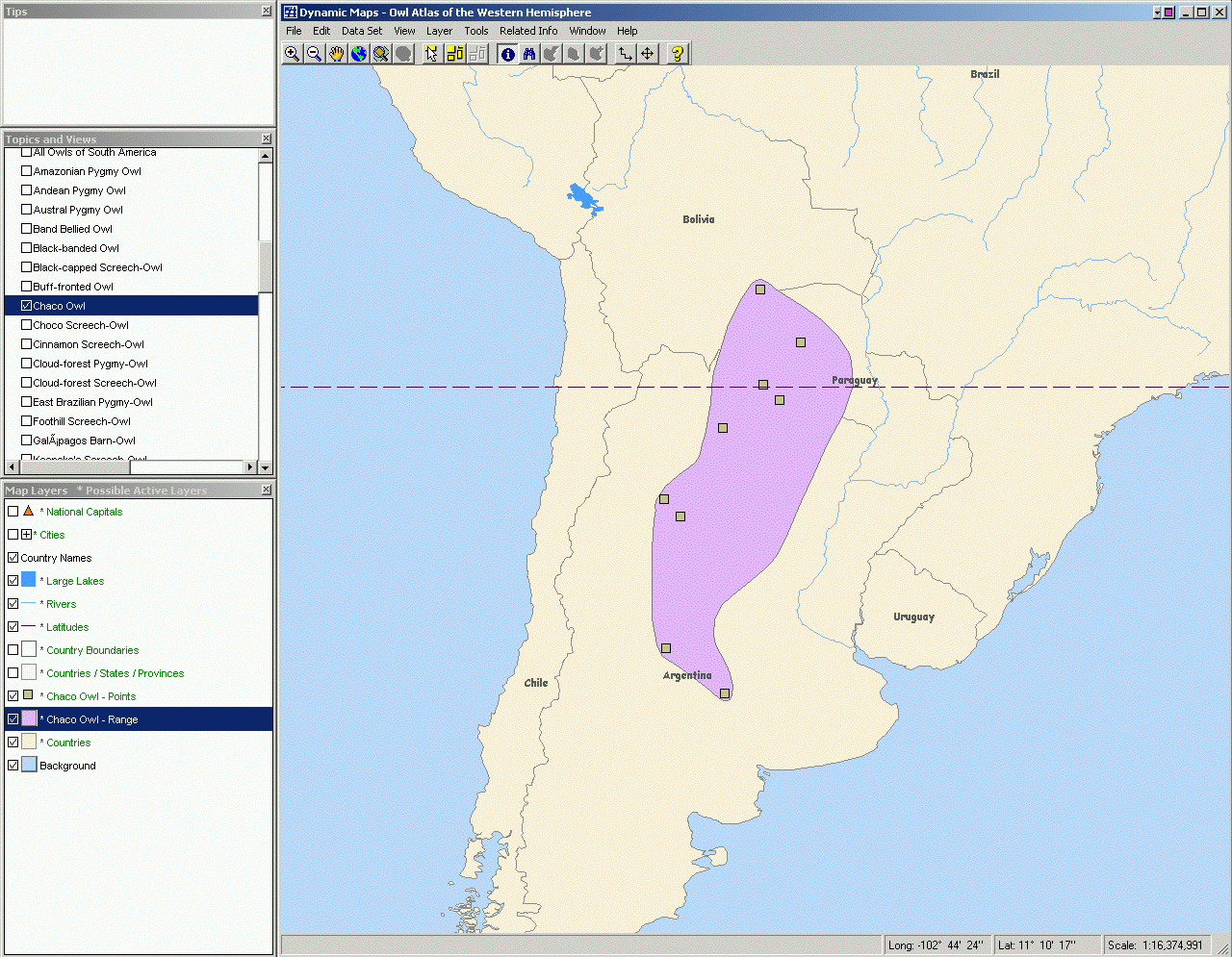
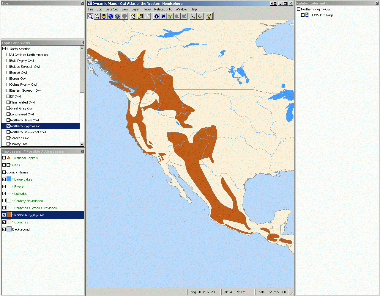
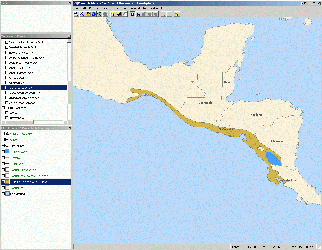
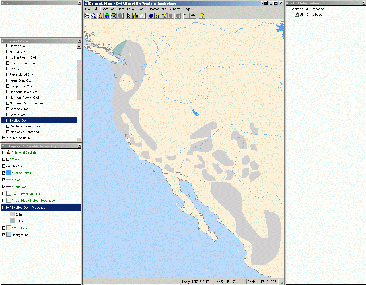
Sample images from the atlas:
How to Get Started:
a) Install Dynamic Maps 3.1.
b) Install the Atlas (it is a self-extracting "zip" file). It will
unzip all the files into "C:\Atlases".
c) IMPORTANT: Because this is older Windows software, you need to run it in Compatibility Mode. Here's how.
d) Run Dynamic Maps and "Import" the atlas by navigating to the "Owls
of the Western Hemisphere" directory.
How to Use: The atlas is arranged in Topics. Each topic has various related map layers and related information (document, web links). To access a topic click on the + beside the topic name to expand the list and/or click in the topic box to get the topic. With each topic you can: turn on and off map layers, change the colors and rendering qualities of the map layers, zoom in and out, select map features, and more. You can even add your own program data, documents, and information to this atlas. Dynamic Maps integrates with PowerPoint for the easy and powerful map creation. You can even ungroup the map in PowerPoint to get individual control of each of the map's features!
Adding you own
data: For virtually any map layer in any topic you can add your own file
or web link to supplement the information in the atlas. Once you do, that information
becomes part of the atlas.
Building Your
Own Atlas
The Owls of the Western Hemisphere Atlas like many others was created with Dynamic Atlas software. Dynamic Atlas makes it easy to organize, integrate and
publish any data and information in a way that is usable to anyone. Dynamic
Maps is free software - so once your atlas is ready, it can be distributed anywhere.
Or publish the atlas directly to the Internet.
If you are interested
in integrating your own data and information and publishing it into an atlas,
or adding new data to this one, please contact:
, Dynamic Planet.
 Find
out more about Dynamic Atlas and Dynamic Planet at www.dynamicplanet.com.
Find
out more about Dynamic Atlas and Dynamic Planet at www.dynamicplanet.com.
Data
Source: Data provided by NatureServe in collaboration with Robert Ridgely, James
Zook, The Nature Conservancy Migratory Bird Program, Conservation International
CABS, World Wildlife Fund US, and Environment Canada WILDSPACE.